|
Geologic Trips, Point
Reyes Peninsula Earthquake Trail The Point Reyes Peninsula is separated from the mainland by
the San Andreas fault. The fault has been
active for over 25 million years. During this period the rocks on the west
side of the fault have moved northwest several hundred miles relative to the
rocks on the east side. The San Andreas fault zone is roughly 1/2 mile wide
and fault movement occurred along many different breaks within the fault zone
at different times. The Bear Valley Visitor Center lies within the fault
zone. The Earthquake Trail, just a short walk from the visitor center, has a number of exhibits that
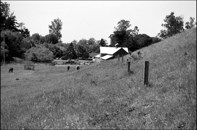
explain the San Andreas fault and the Great San Francisco Earthquake of 1906. The posts in this photo on the Earthquake Trail show
where the San Andreas fault cut along the hillside and then sliced off the corner of the Skinner Barn
during the 1906 earthquake. The barn
has been rebuilt. Exterior Websites National Park Service: USGS:
Geology of Pt Reyes National Seashore Wikipedia:
_____ |
|
The posts show the location of the
San Andreas fault on the Earthquake Trail. |