|
Geologic Trip, Yosemite
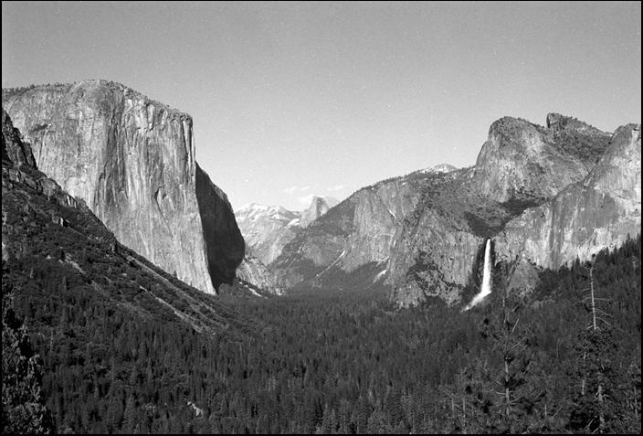
Valley Bridalveil Fall The Tunnel View parking area on
State Route 41 directly east of the Wawona Tunnel provides a excellent view
of Yosemite Valley. During
the Pleistocene glacial episodes, glaciers that began in the Tuolumne icefields filled Yosemite Valley and flowed
down the valley as far west as El Portal. As the glaciers moved down the
valley, they broadened the floor of the valley, steepened the valley walls,
and cut off the lower sections of many of the creeks that
had once flowed directly into the Merced River. When the
ice melted, the upper sections of these creeks
were left hanging high
on the sides of the valley. Bridalveil Fall, at the right side of the photograph,
is a classic example
of one of these “hanging” valleys. The valley of Bridalveil Creek lies 850 feet above the
floor of Yosemite Valley and the fall leaps over a 650-foot near-vertical
cliff where the creek enters the valley. The creek above the waterfall slopes very steeply so that the water is propelled over the edge of the
cliff with great force. Exterior Websites National Park Service: USGS: Yosemite Hikes: _____ |