|
Geologic Trip,
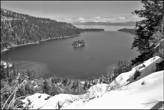
Lake Tahoe Area Emerald Bay The photograph looks across Emerald
Bay toward Lake Tahoe, just beyond the inlet to the bay. Lake Tahoe lies in a
down-dropped block that was formed during the Plio-Pleistocene uplift of the Sierra Nevada. While the mountains were being uplifted, the Tahoe block was dropped about 5,000 feet along a series of large faults that splayed
and opened to the north. This fault-bound
valley was drained by
a north-flowing river. Later, the north part of this valley was filled with
a thick pile of volcanic rocks that
dammed the river
valley. The waters of Lake Tahoe are held in place by this dam. These volcanic rocks extend from Tahoe City and Incline Village north to
Sierraville. Emerald Bay was formed by a glacier
during the last glacial episode. The glacier began in the Desolation
Wilderness ice field. When
the glacier reached Lake Tahoe, it crossed the large boundary fault
on the west side of the Tahoe basin and abruptly entered the lake. Upon
entering the lake, the glacier began to melt and dump its load of glacial
debris along the shoreline. When the glacier retreated, it left the large lateral moraine that now forms the southeast side
of Emerald Bay and the recessional moraine that nearly closes the mouth of
the bay. . Fannette Island in the center of the bay is an outcrop
of granite that rises 150’ from the water. _____ |