|
Geologic Trip, Mono Lakes
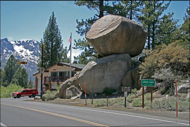
Area June Lake This large perched
boulder near the June Lake Fire Station is a glacial erratic that was left
here when the Reversed Creek glacier melted. The boulder sits on a small
roche moutonnée that is being broken apart by jointing. The basin for June Lake was carved out by the Reversed
Creek glacier. When the glacier melted, the debris that was being carried by the glacier was deposited as moraines and till
in and along the glacial valley. This till covers much of the area
on the east side of Reversed Peak between June Lake and Grant Lake and as far
east as Highway 395. Reversed Creek is
unique. It is the only creek along the entire eastern Sierra that flows west
toward the mountain front rather than away from the mountains. The
reversed drainage was formed when the Reversed Creek glacier encountered hard
rock in the valley floor after it left the base of the Sierra escarpment. The
glacier rode up and over these hard rocks as it continued northeast toward
Mono Lake. The direction of movement of a glacier depends on the slope of ice
surface, not on the slope of the valley floor. As a glacier flows down a
canyon, the bottom of the glacier can scoop out low spots and benches. Thus,
the ice at the bottom of the glacier can travel upslope for some distance. Exterior Websites Mono County: _____ |