|
Geologic Trip, Yosemite
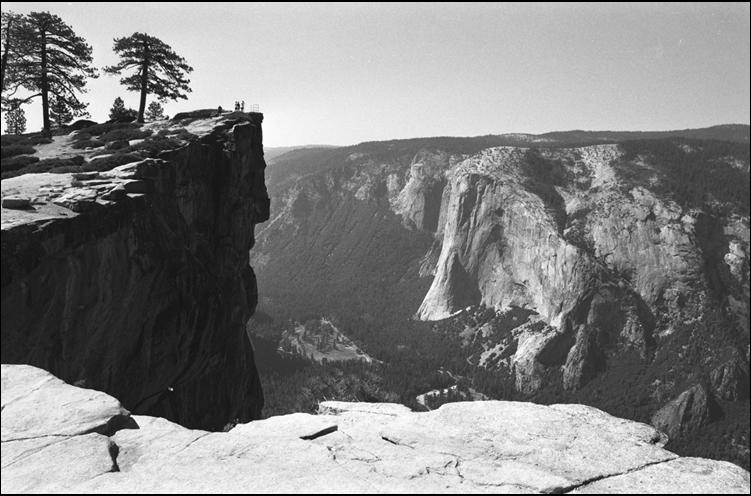
Valley Taft Point Taft Point (left), on the south rim
of Yosemite Valley, provides a great view of Yosemite Valley and El Capitan
on the far side of the valley. From here you can also see the gently rolling
upland surface of the Sierra Nevada along the skyline. This land surface was
formed during Miocene time and has remained unchanged except for uplift and
westward tilting through the Pliocene and Pleistocene. During this uplift,
the Merced River cut a steep canyon into the old Miocene surface. This canyon
was then modified by Pleistocene glaciers to become the scenic Yosemite
Valley that we see today. Exterior Websites National Park Service: USGS: _____ |