|
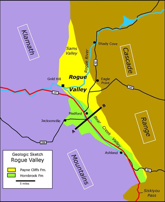
Geologic Trip, Rogue Valley Area Rogue Valley |
|
The
Rogue Valley is an unusual valley in that it is completely surrounded by
mountains. The rugged Klamath Mountains form the western boundary of the
valley and the Cascade Range lies to the east. The valley is pinched off
north of Sams Valley, where these two ranges merge, and south at Siskiyou
Pass where the mountains again merge. The Rogue River escapes the valley by
cutting through the Klamath Mountains from Gold Hill to Grants Pass and then
across the Klamath Mountains until it reaches the Pacific Ocean at Gold
Beach. Why is the valley in the middle of all these mountains and how did the
valley form? Rogue
Valley formed because the valley is underlain by soft sedimentary rocks and
these rocks are more easily eroded than the hard metamorphic and igneous
rocks in the Klamath Mountains and the volcanic rocks of the Cascade Range.
Where there are no sedimentary rocks, there is no valley. Without these
sedimentary rocks there would be no valley. These sedimentary rocks are
referred to as the Hornbrook Formation and the Payne Cliffs Formation. The
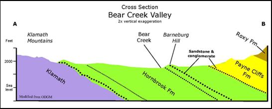
Hornbrook Formation occurs mainly along Bear Creek and the west side of Bear
Creek Valley. Most of these rocks are mudstone and siltstone, but locally
there are beds of thick sandstone and conglomerate. The mudstone and
siltstone is very soft and easily eroded, and Bear Creek follows these soft
rocks for most of its course. The thick sandstones and conglomerates are hard
and resist erosion. These rocks form many of the small hills along the west
side of Bear Creek Valley. Barneburg Hill is formed from some of these thick
sandstone beds. The Hornbrook Formation was deposited in a seaway that
extended along the western margin of the North America from Canada to
California during mid- to late Cretaceous time. The
Payne Cliffs Formation consists of sandstone and mudstone that was deposited
on a broad alluvial plain that had formed in south central Oregon during
Eocene time. These rocks occur mainly in Sams Valley, the northern part of
Rogue Valley and along the eastern side of Bear Creek Valley. The Payne
Cliffs Formation is overlain by volcanic rocks of the Roxy Formation, and
these hard volcanic rocks form a protective cap for the underlying softer
rocks of the Payne Cliffs Formation. During
Miocene time, about 20 million years ago, the Klamath Mountains began to be
uplifted. As uplift continued, the overlying sedimentary and volcanic rocks
were tilted eastward and the sedimentary rocks began to be eroded. Rogue
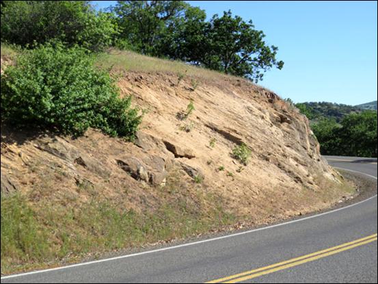
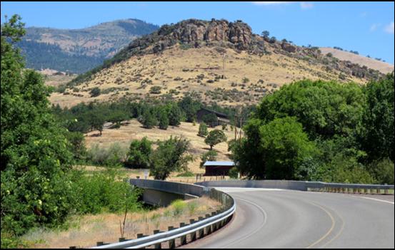
Valley is formed from these tilted and eroded sedimentary rocks. Tilted Rocks. The photo, right, from Dead Indian
Memorial Road, shows tilted rocks of the Payne Cliffs Formation along the
east side of Bear Creek Valley, overlain by volcanic rocks of the Roxy
Formation at the top of the slope. The volcanic rocks of the Roxy Formation
are hard and form a protective cap over the softer rocks of the Payne Cliffs
Formation. The floor of the valley is mainly soft shale and sandstone of the
Hornbrook Formation. Pompadour Bluff is on Dead Indian Memorial Road
one mile east of the Ashland Airport. The bluff is formed from a thick
conglomerate bed in the upper part of the Payne Cliffs Formation and was
probably deposited in a river channel on the Eocene alluvial plain. The east dip
of the conglomerate occurred during Miocene uplift of the Klamath
Mountains. Emigrant Lake. Conglomerate beds of the Payne
Cliffs Formation are well exposed in road cuts near the boat ramp at Emigrant
Lake. Pebbles in these conglomerates were derived from erosion of the Klamath
Terranes and were deposited in a stream on a broad alluvial plain that once
covered much of south central Oregon. The beds are tilted east.
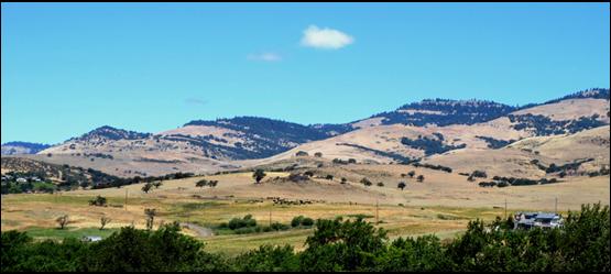
Barneburg
Hill is formed from beds of sandstone,
conglomerate and shale of the Hornbrook Formation that are tilted gently
eastward. The crest of the hill is formed from an especially thick, hard
sandstone bed that has resisted erosion and has given the hill its distinctive
shape. Without this resistant sandstone bed there would be no Barneburg Hill. I-5 S Road Cut. Fossiliferous sandstone of the
Hornbrook Formation is well exposed in a road cut on I-5 South near Mile
Marker 6 on Siskiyou Pass. Most of the fossils in this sandstone are clams
and snails, but sharks teeth, sea urchins, oysters, starfish and coral have
also been found. The sand was deposited as a beach along the shoreline of the
ancestral Klamath Mountains when the late Cretaceous seaway extended through
large parts of Washington, Oregon and California.
Roxy Ann
Peak
is not a volcano. The sharp top of the peak is formed from a thick diabase
dike that has intruded the older sedimentary and volcanic rocks that make up
the lower parts of the mountain. The diabase dike consists of very hard rocks
that have protected the underlying rocks from rapid erosion.
Table
Rocks.
Seven million years ago a lava flow from the Cascade Range followed the Rogue
River west from Lost Creek Lake to Gold Hill and covered much of the valley
floor at that time. Since then, most all of the lava flow has been eroded
from the valley and the valley floor has been lowered several hundred feet.
The flat tops of the Table Rocks are remnants of the lava flow that have not
yet been removed by erosion. External
Websites ODGM:
Geologic Map, Bear Creek Valley SEPM:
Stratigraphy, Payne Cliffs Fm. Return to:
Rogue Valley Area |
|
Roadcut,
Emigrant Lake |
|
Pompadour
Bluff |
|
Tilted Rocks |